Mobile imaging and laser scanning systems create immense datasets that can quickly overwhelm manual workflows, therefore Trimble mobile data capture systems come with Trident software to manage field data capture, interpret images and point clouds, provide
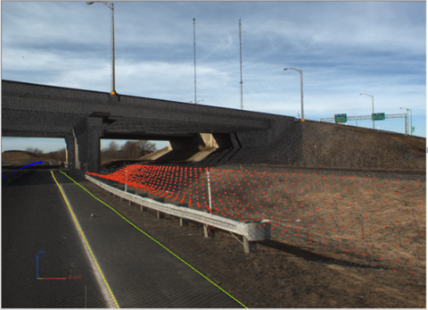
The Trident interface is designed for robust object positioning, measurement, point cloud classification, and data layer creation–ideal for the analysis of geo-referenced imagery and laser scanner data. Industry-leading functions accelerate projects and increase productivity, including key automated processes such as surface modeling, roadway sign and pole detection, lane marking detection, edge and breakline detection, road geometry, and clearance measurements.

Bin Moosa Al Qubaisi Trading
P.O. Box 38017
Al Quoze, Dubai
United Arab Emirates
Tel: +971 (04) 3392217
Fax: + 971 (04) 3392218
G Global Technologies L.L.C.
Loulou Asfar Hotels & Apartments
Muroor Road, 23rd-25th Street
P.O Box 716, Abu Dhabi, UAE
Tel: +971 (02) 6266272
Fax: + 971 (02) 6262559
Bin Moosa Trading & Contracting LLC
PO Box 1371 PC 121
Boushar, Muscat, Oman
Tel: +968 9804 8838
Tel: +968 9808 4241
Copyright © 2024 by Global Technologies
Design and Developed by : IPIX